Forget seismometers. Earthquakes can be charted by analysing infrasound high in the atmosphere, or so Delft researchers found. Their discovery could save lives.
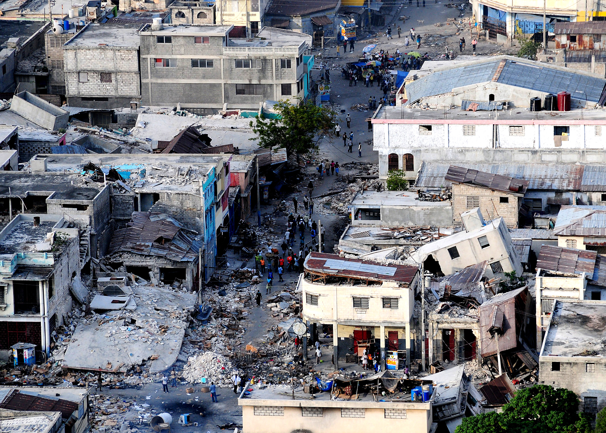
Shahar Shani-Kadmiel: "In the case of the 2010 Port-au-Prince earthquake, a pseudo shakemap could have been compiled in minutes, even though there were no seismometers operating at the time." (Photo: Wikipedia)
On 12 January 2010, a magnitude seven earthquake devastated Haiti. It took days before the extent of the damage was understood, partly because there were no seismometers in the region at the time of the earthquake.
Seismometers are used to create shakemaps, which indicate the distribution of shaking intensity. Shakemaps are a key component for an effective post-earthquake rapid response. In the absence of seismic measurements in earthquake regions, this map is inaccurate. Or so it used to be.
Delft researchers have found a way to circumvent this problem if future disasters like this occur. They are able to pick up acoustic signals – also called infrasound – in the atmosphere caused by earthquakes. “Some of the energy caused by earthquakes leaks into the atmosphere,” says seismic expert Dr Shahar Shani-Kadmiel of the Geoscience and Engineering Department (CEG faculty). “Even if there are no seismic stations anywhere near the epicentre, you can still pick up the signals in the atmosphere thousands of kilometres away and use these to reconstruct the shakemap.”
With a little help from Kim Jong-un
The mathematical model that explains how this energy leaks into the atmosphere has been known for over a century. But until now it was impossible to filter out the faint waves from the background noise in the atmosphere with pressure sensors (barometers).
“Now we can do this because we have had plenty of data to improve our algorithms and calibrate the models,” says Shani-Kadmiel. “Many of these data come from submarine volcanic eruptions. Another important source was the underground nuclear test that North Korea carried out on 3 September 2017 at Punggye-ri, in the north east of the country. This was a much bigger explosion than the ones in the preceding years. It was the equivalent of a magnitude six earthquake.”
The research was carried out in the framework of a NOW-VIDI project, which uses verification measures of the Comprehensive Nuclear-Test-Ban Treaty. The leader of the project, Prof. Läslo Evers (CEG Faculty), is also employed by the Royal Netherlands Meteorological Institute KNMI which surveys the international ban on nuclear tests.
The infrasound signals from the Punggye-ri explosion were detected at the infrasound monitoring station in the Russian Federation, some 400 kilometres from the test site. The station is part of the International Monitoring System (IMS). The IMS consists of dozens of seismic, hydroacoustic and infrasound monitoring stations.
Pressure fluctuations in Bermuda
Part of the infrasound turned out to originate, not directly from Punggye-ri, but from sites many hundreds of kilometres removed from the test site. An analysis of the infrasound signals in combination with the seismic signals showed that ground vibrations were produced as far afield as a river delta on the border of North Korea and Russia and undersea mountain ranges in the Sea of Japan. The vibrations had travelled from these sites into the atmosphere, generating infrasound.
The Delft researchers used the new insights on the wave propagation to ameliorate their shakemap algorithms for earthquakes. An article about how they reconstructed the shakemap of the 2010 Haiti disaster has been submitted to Nature as a proof-of-concept. In this work, they analysed pressure fluctuations recorded by an International Monitoring System array on Bermuda island, over 1,700 kilometres from Haiti.
“In regions where there are no seismic stations, and even in regions where coverage of the seismic network is limited, this information may prove crucial for post-disaster relief efforts,” says Shani-Kadmiel. “In the case of the 2010 Port-au-Prince earthquake, a pseudo shakemap could have been compiled in minutes, even though there were no seismometers operating at the time.”
‘Now we have a tool to see through layers of the earth that used to be opaque’
Another publication the team is working on revolves around an underground earthquake off the coast of Alaska a few years ago. It occurred beneath four kilometres of water and at 22 kilometres depth in the earth’s crust. “We were able to pick up infrasound from this earthquake through leakages of energy through the water column. So now we have a tool to see through layers of the earth that used to be opaque. We can see through the ocean and generate an indirect measurement of ground motion on the ocean floor where deploying and maintaining seismic stations is a headache.”
The technique could also be of interest for extra-terrestrial planetary exploration. “Let’s say you want to know more about the internal structure of Venus. You cannot put seismometers on Venus as we did on Mars and on the Moon because the surface is much too hot. But you can release weather balloons into Venus’ atmosphere, measure acoustic waves and try to understand the seismic fields that created them.”
Do you have a question or comment about this article?
tomas.vandijk@tudelft.nl


Comments are closed.