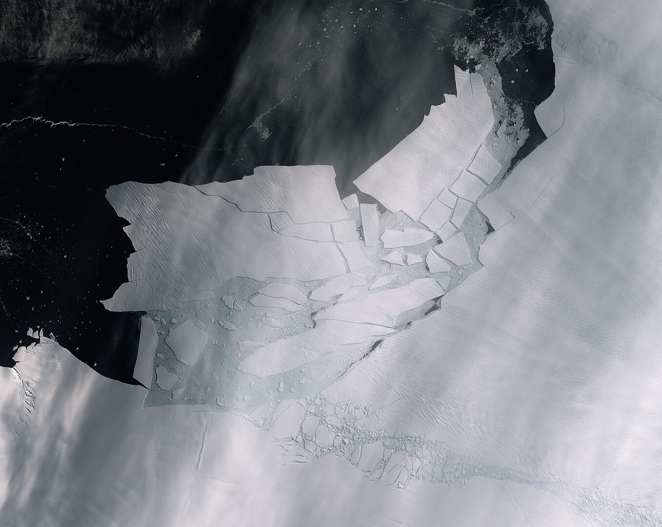
The world’s largest glacier, Antarctic’s Pine Island Glacier, spawned an iceberg of over 300 square km – twice the size of Amsterdam – that very quickly shattered into pieces.
This image, captured on 11 February by the Copernicus Sentinel-2 mission, shows the freshly broken bergs in detail. (Photo: ESA)
Thanks to the combination of both optical and radar images from the Copernicus Sentinel satellite missions, growing cracks were spotted in the Pine Island Glacier last year. Since then, scientists have been keeping a close eye on how fast the cracks were growing. This almost cloud-free image, captured on 11 February by the Copernicus Sentinel-2 mission, shows the freshly broken bergs in detail.
One of the researchers who is investigating the cracks, is satellite remote sensing expert at TU Delft, Bert Wouters (Department of Physical and Space Geodesy). He sees a worrisome development. “The frequency of Pine Island Glacier calving events has increased. Every year large pieces are now breaking off. Up to the early 2000s, calving used to occur every five years on average.”
‘This glacier accounts for 10% of global sea level rise’
The area drained by the Pine Island Glacier comprises about 10% of the West Antarctic Ice Sheet. Satellite measurements have shown that the Pine Island Glacier Basin delivers a greater net proportion of ice to the sea than any other ice drainage basin in the world. “It accounts for 10% of global sea level rise,” says Wouters. And he is worried that this percentage could increase quickly.
The glacier is losing mass from a combination of calving events and strong basal melting, where warm ocean currents erode the underside of a floating ice shelf. As the ice shelf thins and calves enormous icebergs, the glacier discharge is unable to replenish the ice lost and the ice shelf recedes.
Wouters and colleagues are working on models that will predict how the glacier will develop in the coming decades.
- More about the Copernicus Sentinel-2 mission here
Do you have a question or comment about this article?
tomas.vandijk@tudelft.nl


Comments are closed.